The Science of Where – Officially in Libya
AZDO Systems is proud to be the first official partner within the region of Libya providing the latest and most advanced GIS solutions to the Libyan market with locally qualified Engineers, bringing the best of the best to our clients at your fingertips.
What is GIS?
GIS is a framework to organize, communicate, and understand the science of our world

- Identify problems
- Monitor change
- Manage & respond to events
- Perform forecasting
- Set priorities
- Understand trends
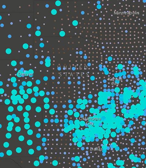
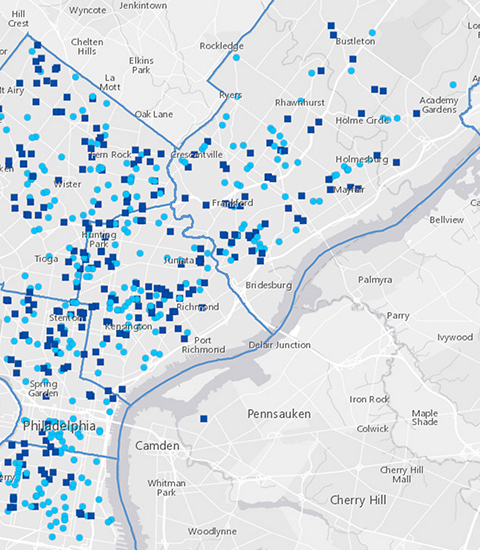
Identify Problems
Use GIS to illuminate issues that are driven by geography. This map of opioid prescription claims reveals the geographic patterns that emerge when data is well-mapped.
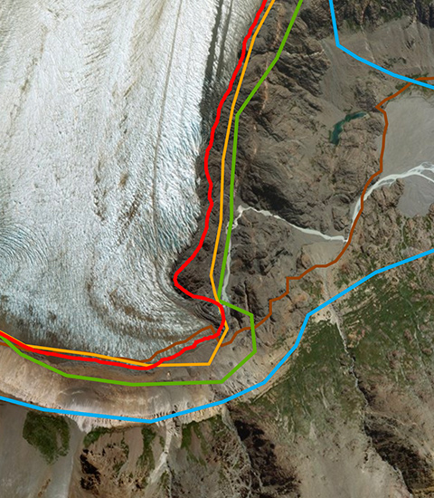
Monitor Change
If a picture tells a thousand words, a map tells a thousand pictures. This map starkly reveals the extent of glacier retreat in the Southern Hemisphere.
Look at the Patagon Journal Memories of Ice map
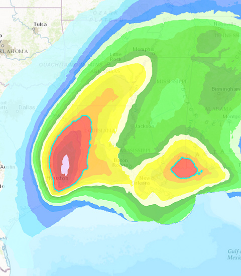
Manage & Respond to Events
GIS delivers real-time situational awareness. This hurricane and cyclone map shows potential impact to people and businesses, probable track of storms, and storm surge.
Try the Hurricane and Tropical Cyclones map
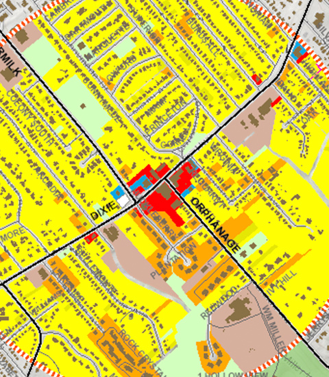
Perform Forecasting
Use GIS to forecast traffic. This map highlights challenges at an intersection in Fort Mitchell, Kentucky, where forecasting shows traffic is expected to worsen based on land use changes.
Open the NKYmapLAB interactive map
Set Priorites
GIS helps to set priorities based on spatial analysis. By analyzing crime patterns, public safety officials can identify target areas and assign officers in those areas.
Take a look at a crime response map
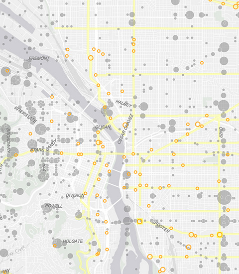
Understand Trends
GIS helps you gain insight into data that might be missed in a spreadsheet. This map measures job growth or losses in different industries and quantifies local competitive advantage.
Try the shift-share analysis map
How GIS Works
GIS technology applies geographic science with tools for understanding and collaboration. It helps people reach a common goal: to gain actionable intelligence from all types of data.

Maps
Maps are the geographic container for the data layers and analytics you want to work with. GIS maps are easily shared and embedded in apps, and accessible by virtually everyone, everywhere.

Data

Analysis

Apps
Who Uses GIS?
Modern GIS is about participation, sharing, and collaboration. Discover how the technology is strengthening relationships, driving efficiencies, and opening communications channels in your community.